Bonpland
Contents
Bonpland
|
Lat: 8.3°S, Long: 17.4°W, Diam: 60 km, Depth: 0.73 km, [/R%C3%BCkl%2042 Rükl: 42] |
Table of Contents
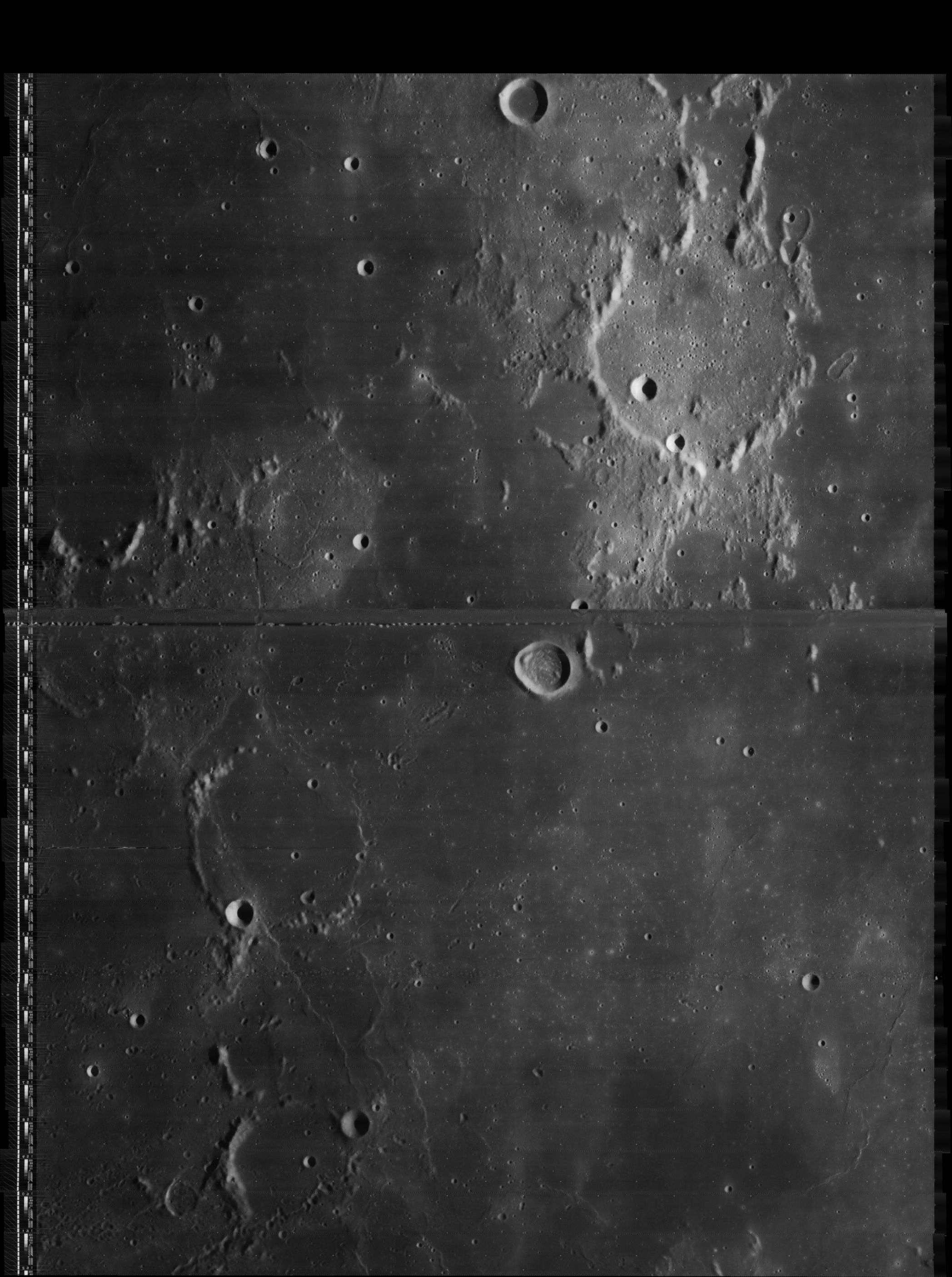
 Apollo 16 AS16-M-1687; Bonpland is the largest crater entirely in view, Parry is to its right, Fra Mauro to its north. The small bowl-shaped crater south of Bonpland and Parry is Tolansky.
Images
LPOD Photo Gallery Lunar Orbiter Images Apollo Images
- Lunar Orbiter 5's Frame 138 shows a close-up of the well-known junction at Fra Mauro, Bonpland, and Parry.
- The curious craterlet Bonpland D with its rare "double western rim" (possibly caused by the nearby Dorsum Guettard) was captured near the upper left corner of Lunar Orbiter 4's frame LOIV-120-h2. Bonpland D is located south-southwest of Bonpland itself, on the eastern part of Mare Cognitum.
Bonpland D was also captured on Apollo 16's orbital Hasselblad photograph AS16-120-19243, and on several ITEK-panoramic photographs, such as AS16-P-5429, which makes me wonder if Bonpland D is perhaps an oblique impact crater (?).
Research Lunar Orbiter and Apollo photographs: Danny Caes
Maps
([/LAC%20zone LAC zone] 76C1) LAC map Geologic map LM map LTO map
USGS Geologic Map of the Bonpland PQC region (I-678)
USGS Geologic Map of the Bonpland H region (I-693)
Description
Description: Elger
([/IAU%20Directions IAU Directions]) BONPLAND.--A ruined walled-plain with a low and much broken wall, which on the S.E. appears to be an attenuated prolongation of that of [/Parry Parry]. It is of the linear type, the formation approximating in shape to that of a pentagon. The floor is crossed from N. to S. by a fine cleft which originates at a crater beyond the S. wall, and is visible as a light streak under a high light. Schmidt shows a short cleft on the E. of this.
Description: Wikipedia
Additional Information
- Depth data from [/Kurt%20Fisher%20crater%20depths Kurt Fisher database]
Pike, 1976: 0.73 km
Westfall, 2000: 0.73 km
Cherrington, 1969: 1 km - Bonpland D and [/Dorsum%20Guettard Dorsum Guettard] (southwest of Bonpland itself) are mentioned in [/APOLLO%20OVER%20THE%20MOON APOLLO OVER THE MOON]: A VIEW FROM ORBIT, Chapter 7: Unusual Features (Part 2), Figure 246.
- Bonpland is a thermal anomaly crater, implying a youthful age - [/Moore%20et%20al%2C%201980 Moore et al, 1980]
Nomenclature
Aimé Jacques Alexandre Bonpland (August 22, 1773 - May 4, 1858) was a French explorer and botanist.
LPOD Articles
Bibliography
- Bonpland and Fra Mauro:
  APOLLO OVER THE MOON; A VIEW FROM ORBIT, Chapter 3: The Terrae (Part 2), Figure 44. Chapter 4: The Maria (Part 3), Figure 94.
  A Portfolio of Lunar Drawings (Harold Hill), pages 107 - 109.
This page has been edited 1 times. The last modification was made by - tychocrater tychocrater on Jun 13, 2009 3:24 pm - afx3u2