Bobone
Contents
Bobone
|
Lat: 26.9°N, Long: 131.8°W, Diam: 31 km, Depth: km, Rükl: (farside), Eratosthenian | |
Images
LPOD Photo Gallery Lunar Orbiter Images Apollo Images
Maps
(LAC zone 52B3) USGS Digital Atlas PDF
Description
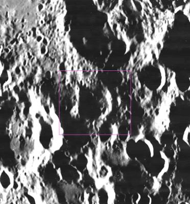
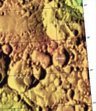
Bobone is situated some 600 kilometres north of the Hertzsprung Basin -- a 570 kilometre-wide basin of the Nectarian period (~ 3.92 to 3.85 bn years), and lies in an area of ejecta thrown nearly twice that distance from the Orientale Basin in the south-east. Besides the effects that both these dominant features have had on the crater over time, Bobone looks lost amidst the futher jumble of larger impact craters nearby, like, Kovalevskaya Q to its north and Bronk to its south-west. The true, but worn, rim of the crater can only be seen in the eastern and western sectors, while its northern and southern sectors have been completly altered by movement of material in the region and by countless small impacts all around. NB. The crater has been given an Eratosthenian age above (see top). Is this correct? Nearby influence of older events in the region as well as its overall appearance suggest it is much older (age was left alone for correction at time of this description)?- JohnMoore2
Description: Wikipedia
Additional Information
Nomenclature
- Jorge; Argentinean astronomer (1901-1958).
  - On the Hallwag map of the moon's farside, Kovalevskaya Q is called Bobone. The same phenomenon is seen on the Reidel-Dordrecht farside map made by Antonin Rukl.- DannyCaes May 15, 2011
LPOD Articles
Bibliography

