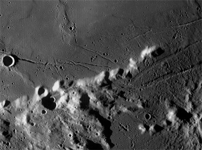
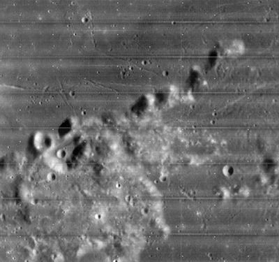
Promontorium Archerusia
Contents
Promontorium Archerusia
(current IAU name; formerly Pr. Acherusia)
|
Lat: 16.7°N, Long: 22.0°E, Diam: 10 km, Depth: 1.5 km, Rükl: 24 | |
Right: LO4-085-h2 The IAU’s Promontorium Archerusia, the eastern-most point in the Montes Haemus range, is the last isolated peak in the upper right.
Images
LPOD Photo Gallery Lunar Orbiter Images Apollo Images
- Promontorium Archerusia was also captured by the Metric/ Mapping Fairchild camera of Apollo 17. Frames AS17-M-1661 and AS17-M-2414 show oblique southward looking views of both Plinius and Promontorium Archerusia.
- Research orbital Apollo 17 photography: Danny Caes
Maps
(LAC zone 42C4) LAC map Geologic map LM map LTO map
Description
Description: Elger
(IAU Directions) PROM. ACHERUSIA.--A bright promontory at the E. extremity of the Haemus range, rising nearly 5,000 feet above the Mare Serenitatis. N. lat. 17 deg., E. long. 22 deg.
Description: Wikipedia
Additional Information
- Depth data from Kurt Fisher database
- Viscardy, 1985: 1.5 km
- Promontorium Archerusia, Rimae Plinius, Brackett, Dorsum Nicol, and the northern part of crater Plinius's rim, are depicted on the cover of the album Apollo: Atmospheres and Soundtracks by Brian Eno, Daniel Lanois, and Roger Eno (1982). This orbital handheld Hasselblad photograph (AS17-150-23069) looks great on the L.P.-edition which appeared in the early eighties! -- Danny Caes
Nomenclature
- Named after the cape on the Black Sea.
- According to Whitaker (p. 209), of the many names introduced by Hevelius, Promontorium Archerusia is one of just ten that have survived into modern usage, (although not used by Riccioli); and one of only four still used at the original location. Hevelius shows it on his nomenclature map and lists it in his gazetteer.
- According to historian Robert Garfinkle, Hevelius' version of the name is a misspelling of Acherusia (without the first 'r'), a semi-mythical name which Hevelius associates with the terrestrial Black Sea (Pontus Euxinus, or Black Sea, being Hevelius' name for the combination of Mare Serenitatis and Mare Tranquillitatis, separated by this promontory). From an 1851 encyclopedia of Greek and Roman mythology: "Acherusia was the name of a peninsula, near Heraclea in Bithynia, with a deep chasm, into which Hercules is said to have descended to bring up the dog Ceberus."
- Mary Blagg, in her Collated List (where it appears as catalog entry 585) found it referred to as Pr. Acherusia (without the first 'r') by all three of her authorities, although Neison, 1876 inserted an 'r' when labeling it on his map.
- The name entered the original IAU nomenclature of Named Lunar Formations as Pr. Acherusia, with the name attributed to Hevelius.
- Kuiper et al., in Table III to their Photographic Lunar Atlas, noted that Beer and Mädler had mangled Hevelius' spelling, and recommended reinstating the 'r'. Their recommendation was approved by the IAU in 1961, although as Garfinkle points out, the IAU appears to have reinstated an earlier error.
LPOD Articles
Bibliography

