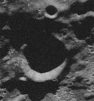
Ibn Bajja
Contents
Ibn Bajja
|
Lat: 86.4°S, Long: 72.81°W, Diam: 12.6 km, Depth: km, Rükl 73 |
Table of Contents
[#Ibn Bajja Ibn Bajja]
[#Ibn Bajja-Images Images]
[#Ibn Bajja-Maps Maps]
[#Ibn Bajja-Description Description]
[#Ibn Bajja-Description: Wikipedia Description: Wikipedia]
[#Ibn Bajja-Additional Information Additional Information]
[#Ibn Bajja-Nomenclature Nomenclature]
[#Ibn Bajja-LPOD Articles LPOD Articles]
[#Ibn Bajja-Bibliography Bibliography]

Donald and Bruce Campbell Ibn Baja is the circular crater at the center of this image synthesized from 12.6 cm radar data. The direction towards Earth is at the top. The ridge above Ibn Bajja is part of the elevated rim encircling the depressed area containing Cabeus.
Images
LPOD Photo Gallery Lunar Orbiter Images
Maps
(LAC zone 144C2) USGS Digital Atlas PDF
Description
Description: Wikipedia
Additional Information
Nomenclature
- Named for Ibn Bajja (c. 1095-1138), a Spanish-Arab astronomer and philosopher.
- New name approved by the IAU on January 22, 2009.
LPOD Articles
Bibliography
This page has been edited 1 times. The last modification was made by - tychocrater tychocrater on Jun 13, 2009 3:24 pm - afx4